Return to Byron Bay ~ April 2015
Since we have fallen in love
with this area, it would be a first pick whenever we return to Australia to visit years from now, and definitely
(thus far) a first pick for permanent property if we kept our minds and hearts
open to purchasing a home here in the future. So, the history of this area is of great interest to us. In fact, the history of just about any area we visit is important, as I fully believe the past is a true lifeline to the present. The landscape, the topography, the occupations and skills of the early settlers, all of this literally shapes a community and carves it out of the vast wilderness it once was, prior to civilization. Because we are interested in the rich Aboriginal history of this great nation, we find it factors into just about every community. It definitely does here in this tiny little seaside town. Here is a synopsis (my version) of Byron Bay’s history:

by a series of volcanic activity that initiated somewhere in the neighborhood of about 20 million years ago. For anyone who cares to do the math, that’s about 7,304,843,981.5 days of sunshine, mild temperatures, and beautiful wave action on this perfect coastline that has been forming and reforming for millions of years. The lava
flows alone from this volcanic activity covered over 3000 square miles (about 5000 kilometers) in all directions, forming what is today the largest
shield volcanic caldera in the Southern Hemisphere.
sacred site to the local Arakwal and
Bundjalung people. Byron Bay is at
the junction of this large group’s northern and southern tribes, the
Minjangbal and the Arakwal.
few know that Mount Warning is the first place in Australia to be
touched by the sun each morning! A climb to Mount Warning’s summit to
watch the sunrise is a bucket-list climb for anyone with an adventurous spirit, but it is not for the faint-hearted. Here is a view of Mt. Warning (photo gleaned from a local camping website):

The trail to the summit has over 1000 steps (that’s like
climbing a 30 story skyscraper). There is approximately 8.8 km of
track to complete the trip up and back down the mountain. The diversity of flora and fauna is unimaginable- with over 200 species that cannot be found anywhere
else on earth.
The mountain itself has 4 distinct environments as you climb–
subtropical rainforest, temperate rainforest, wet forest and shrub land. As you ascend the mountain the weather can change
considerably and temperatures can noticeably drop as you approach the
peak, so you have to be prepared for anything. The last part of the climb is quite steep, and is accomplished by chain.

There is a wonderful vista that awaits you of the entire region, once you reach the peak. Most people initiate their climb at about 4:30 am so they can reach the peak by sunrise, but I’m not sure I’m favorable to climbing in the dark. Especially by chain. We’ll have to see, once the arm heals and I can actually carry my own weight, as is necessary when attempting the part by chain.
As the tributaries surrounding the bay are an integral part of the history and the settlement of the region, I’m including a map of the area. Nimbin is a junction point, and is in fact an interesting part of the history, as well. I’ll get to that later, but make note of the location!

DISCOVERY BY CAPTAIN JAMES COOK, 1770:
James Cook and his ship the Endeavour sailed past Australia ‘s most
easterly point in May of 1770. Cook and his crew of about 100 men left Plymouth, England in August
of 1768, secretly to discover and explore this mystery continent (Australia). Throughout a several month voyage, the Endeavour traveled via Madeira,
Rio de Janiero and Tierra del Fuego (pretty much the depths of Hell, according to Cook). From there, he rounded Cape Horn into the Pacific Ocean, on to Tahiti. He first hit New Zealand, and then in April 1770 made it to the NE coast of Australia, naming this area New Holland. Botany Bay was where the crew first stepped on Australian land, on 26 April 1770. When Cook finally arrived in what is now Byron Bay in May, he named the headland Cape Byron and the looming mountain above it Mount Warning. He wanted it to serve as a warning to seafarers
traversing the very dangerous reefs along the coast.
region in the late 1840s, the area was surrounded by a subtropical rainforest known as the Big Scrub that covered about 24,000 acres, much of which was
cleared to make way for sugar cane, cattle and dairy farmers who took
advantage of the millions of years of rich alluvial deposits on the crater floor. The tiny town of Cavanbah (later Byron Bay) was born in the 1880s. Construction of the beautiful lighthouse initiated in 1899 and was completed in 1901.
Because of the advantageous position near a large coastal railway line and the huge fishing jetty/wharf on Byron Bay, the export of butter, sugar cane, timber and meat (along with a thriving fishing industry) allowed the tiny hamlet to prosper and grow into a busy community. During the depression of the 1930s, the town survived off of two of these booming industries- butter and meat. The Norco butter factory was established at Byron Bay in 1895, and the rich butter was exported to England, after rapid technological developments allowed for safe storage on the long journey. These industries survived and thrived through several economic downturns over the next half century. However, in 1954, a major cyclone smashed the coastline, and the fishing industry was literally demolished when the large jetty and many fishing boats in the harbor area were annihilated. The whaling industry, which had been a primary source of prosperity for the fishermen also was decimated, although this was largely due to declining whale populations as well.
The late 60’s saw a rapid decline in dairy farming. There are many factors that precipitated this massive shift in industry there, but the predominant factor appears to be that England stopped importing butter from Australia at that time. Post World War II, much of Europe shifted toward industries that were either subsidized or approved by Governments overseeing war reparations. As large factories were on the decline (or repurposed) due to restrictions preventing potential weaponry manufacturing, dairy (approved for peacetime needs) was a logical choice for many European countries, especially Germany. This initiated as largely a cottage industry, barely able to supply the needs for local consumption. After a period, these factories were expanding enough to support a solid exporting business to surrounding countries in Europe. Butter prices declined, thus paving the way for the rapid decline and death spiral for butter exporting in Byron Bay.
campaign in the 1970s signaled the beginnings of a new fascination
with Byron Bay~ the tourism industry. As the whale population slowly recovered after global
opposition to their slaughter rose, people returned to the Cape to enjoy the sights of
their annual migration in these beautiful scenic bays. Whale watching became a vital part of the
area’s ecotourism.
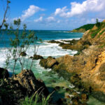
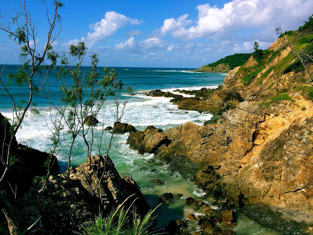
Byron for myriad reasons but the flora and fauna, and the scenic and ever-changing
landscape were the largest attractions, much the same reasons for the earlier migration of the indigenous peoples into the region. The Nimbin valley in particular, which had been for
thousands of years a sacred place for the Bundjalung peoples,
attracted the interest of a group of students from Canberra University. At the time, Nimbin’s economy was in decline after the UK ceased importing Australian butter. The environment and the industry of the region was rapidly changing, and the time was ripe for a new era.

1973… the dawn of the Aquarius Festival and of a new era for the Byron Bay region…
the hippie capital of Australia and sister city to Woodstock in
the USA), here is that story. In 1973, the Aquarius Festival was conceived and established as a counter-cultural music and art festival organized by the Australian Union of Students. This literally was Australia’s version of Woodstock. The
Aquarius organizers approached the local Aboriginal elders to seek their
permission to hold a festival in Nimbin. The culture of this new wave of thinkers was in line with a total respect for the indigenous people, their land
and their culture. The value systems of these organizers was a
universally-held belief in the importance of reconciliation- being at one with the land and the culture.
but not necessarily daily life as any of us know it. Students and hippies flocked to the area
for the festival in 1973. As this environment was in concert with their way of thinking, and a simpler, more laissez-faire type of life, many chose to stay. Several decades of counterculture lifestylers began to repopulate the area and
eventually a commune around Mullumbimby and
Mainarm popped up. This commune (Avalon) was then formally established- not an easy task as you are technically dividing unequal land into equal shares amongst unequal families. For instance, who gets direct access to the water hole, which family gets the most fertile farming plot, etc. Despite the logistical issues, this commune eventually paved the way for Bush medicine and holistic/herbal practices, which enhanced the alternative lifestylers’ raison d’etre (reason for existence). And the hippies were not the only ones to get into the act. In
conjunction with the environmentally-friendly, health theme of the area, industrial producers
turned to the cultivation of tropical fruits, macadamia
farms and tea tree plantations.
| Nimbin is an authentic alternative (translate “hippie”) village nestled in the scenic Nimbin Valley. The Nimbin museum in the main street depicts views of the history of this unique little village. It is an experience you will never forget if you choose to visit! |


 |
ALAS, THE MYSTERY MACHINE – FOUND!!!! |
As my hubby said “And I always wondered what happened to those meddling kids! They are solving mysteries in Byron Bay it appears!” Gotta love all those classic Scooby-Doo characters!